


FEMA National Risk Index for Natural Hazards - by Zip code
Regular price
$9,900.00
Sale
FEMA National Risk Index for Natural Hazards - By Zip Code
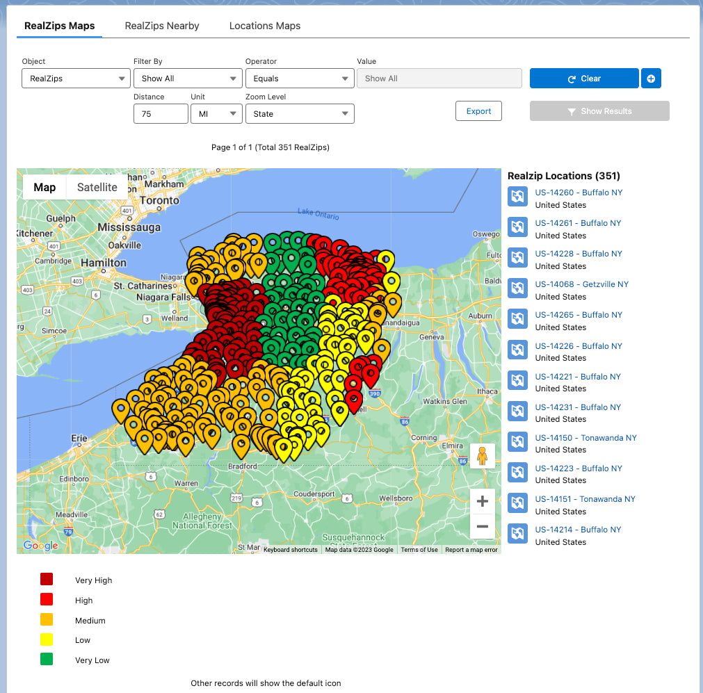
Required app: RealZips for Salesforce
Format: Microsoft Excel / 150 Mb
Latest update: Sept 2023
This dataset is based on the FEMA National Risk Index for Natural Hazards by County. You can access the County-based data and maps on the FEMA website.
The dataset is converted from County-level - down to a Zip code level - in order to automatically enrich your the entire Salesforce CRM database with critical Risk Index datapoints.
Dataset Scope
- 41,350 Zip code records
- Up to 450 datapoints per zip code record
Sample Use Cases
-
Help communities reduce future disasters’ effects on lives and property.
- Understand and mitigate risk exposure across your customers and stakeholders.
- Provide products and services, to help protect lives and assets.
- Create automated geographic risk profiling, integrated with Salesforce records.
Included Professional Services: 8 hours
- Discussion and selection of critical datapoints.
- Preparation and upload of select datapoints into RealZips app.
- Creation of organization-specific indexes and analytics in Salesforce.
- Enhance existing Salesforce records with Hazard Risk data.
Categories of Natural Hazard Risk Indexes
- Avalanche
- Coastal Flooding
- Cold Wave
- Drought
- Earthquake
- Hail
- Heat Wave
- Hurricane
- Ice Storm
- Landslide
- Riverine Flooding
- Strong Wind
- Tornado
- Tsunami
- Volcanic Activity
- Wildfire
- Winter Weather
Included datapoints - by US Zip code
| API Name | Field Label | Sample Data |
| RealZips Ext ID | RealZips Unique ID | RZ-US-00501 |
| County | County Name | Suffolk |
| State | State Name | NY |
| FIPS County | FIPS County | 36103 |
| County ST | County ST | Suffolk NY |
| COUNTYTYPE | County Type | County |
| STCOFIPS | State-County FIPS Code | 36103 |
| POPULATION | Population (2020) | 1524969 |
| BUILDVALUE | Building Value ($) | 3.49103E+11 |
| AGRIVALUE | Agriculture Value ($) | 258729959 |
| AREA | Area (sq mi) | 2397.211163 |
| RISK_VALUE | National Risk Index - Value - Composite | 166046352.3 |
| RISK_SCORE | National Risk Index - Score - Composite | 97.1364938 |
| RISK_RATNG | National Risk Index - Rating - Composite | Relatively High |
| RISK_SPCTL | National Risk Index - State Percentile - Composite | 96.77419355 |
| EAL_SCORE | Expected Annual Loss - Score - Composite | 97.89538842 |
| EAL_RATNG | Expected Annual Loss - Rating - Composite | Relatively High |
| EAL_SPCTL | Expected Annual Loss - State Percentile - Composite | 100 |
| EAL_VALT | Expected Annual Loss - Total - Composite | 179185932 |
| EAL_VALB | Expected Annual Loss - Building Value - Composite | 154461013.6 |
| EAL_VALP | Expected Annual Loss - Population - Composite | 2.052562747 |
| EAL_VALPE | Expected Annual Loss - Population Equivalence - Composite | 23809727.87 |
| EAL_VALA | Expected Annual Loss - Agriculture Value - Composite | 915190.5954 |
| ALR_VALB | Expected Annual Loss Rate - Building - Composite | 0.000442451 |
| ALR_VALP | Expected Annual Loss Rate - Population - Composite | 1.34597E-06 |
| ALR_VALA | Expected Annual Loss Rate - Agriculture - Composite | 0.003537242 |
| ALR_NPCTL | Expected Annual Loss Rate - National Percentile - Composite | 29.24791086 |
| ALR_VRA_NPCTL | Social Vulnerability and Community Resilience Adjusted | 22.68533248 |
| SOVI_SCORE | Social Vulnerability - Score | 26.45000076 |
| SOVI_RATNG | Social Vulnerability - Rating | Relatively Low |
| SOVI_SPCTL | Social Vulnerability - State Percentile | 0.193548387 |
| RESL_SCORE | Community Resilience - Score | 94.80999756 |
| RESL_RATNG | Community Resilience - Rating | Very High |
| RESL_SPCTL | Community Resilience - State Percentile | 0.983870968 |
| RESL_VALUE | Community Resilience - Value | 2.802092075 |
| CRF_VALUE | Community Risk Factor - Value | 0.926670696 |
| AVLN_EVNTS | Avalanche - Number of Events | 0 |
| AVLN_AFREQ | Avalanche - Annualized Frequency | 0 |
| AVLN_EXP_AREA | Avalanche - Exposure - Impacted Area (sq mi) | 0 |
| AVLN_EXPB | Avalanche - Exposure - Building Value | 0 |
| AVLN_EXPP | Avalanche - Exposure - Population | 0 |
| AVLN_EXPPE | Avalanche - Exposure - Population Equivalence | 0 |
| AVLN_EXPT | Avalanche - Exposure - Total | 0 |
| AVLN_HLRB | Avalanche - Historic Loss Ratio - Buildings | 0 |
| AVLN_HLRP | Avalanche - Historic Loss Ratio - Population | 0 |
| AVLN_HLRR | Avalanche - Historic Loss Ratio - Total Rating | Not Applicable |
| AVLN_EALB | Avalanche - Expected Annual Loss - Building Value | 0 |
| AVLN_EALP | Avalanche - Expected Annual Loss - Population | 0 |
| AVLN_EALPE | Avalanche - Expected Annual Loss - Population Equivalence | 0 |
| AVLN_EALT | Avalanche - Expected Annual Loss - Total | 0 |
| AVLN_EALS | Avalanche - Expected Annual Loss Score | 0 |
| AVLN_EALR | Avalanche - Expected Annual Loss Rating | Not Applicable |
| AVLN_ALRB | Avalanche - Expected Annual Loss Rate - Building | 0 |
| AVLN_ALRP | Avalanche - Expected Annual Loss Rate - Population | 0 |
| AVLN_ALR_NPCTL | Avalanche - Expected Annual Loss Rate - National Percentile | 0 |
| AVLN_RISKV | Avalanche - Hazard Type Risk Index Value | 0 |
| AVLN_RISKS | Avalanche - Hazard Type Risk Index Score | 0 |
| AVLN_RISKR | Avalanche - Hazard Type Risk Index Rating | Not Applicable |
| CFLD_EVNTS | Coastal Flooding - Number of Events | 0 |
| CFLD_AFREQ | Coastal Flooding - Annualized Frequency | 3.794454726 |
| CFLD_EXP_AREA | Coastal Flooding - Exposure - Impacted Area (sq mi) | 22.53432062 |
| CFLD_EXPB | Coastal Flooding - Exposure - Building Value | 22121253794 |
| CFLD_EXPP | Coastal Flooding - Exposure - Population | 64169.17786 |
| CFLD_EXPPE | Coastal Flooding - Exposure - Population Equivalence | 7.44362E+11 |
| CFLD_EXPT | Coastal Flooding - Exposure - Total | 7.66484E+11 |
| CFLD_HLRB | Coastal Flooding - Historic Loss Ratio - Buildings | 0.002083135 |
| CFLD_HLRP | Coastal Flooding - Historic Loss Ratio - Population | 3.30474E-06 |
| CFLD_HLRR | Coastal Flooding - Historic Loss Ratio - Total Rating | Very Low |
| CFLD_EALB | Coastal Flooding - Expected Annual Loss - Building Value | 13242591.59 |
| CFLD_EALP | Coastal Flooding - Expected Annual Loss - Population | 0.064124236 |
| CFLD_EALPE | Coastal Flooding - Expected Annual Loss - Population Equivalence | 743841.1395 |
| CFLD_EALT | Coastal Flooding - Expected Annual Loss - Total | 13986432.73 |
| CFLD_EALS | Coastal Flooding - Expected Annual Loss Score | 97.26495726 |
| CFLD_EALR | Coastal Flooding - Expected Annual Loss Rating | Relatively High |
| CFLD_ALRB | Coastal Flooding - Expected Annual Loss Rate - Building | 3.79332E-05 |
| CFLD_ALRP | Coastal Flooding - Expected Annual Loss Rate - Population | 4.20495E-08 |
| CFLD_ALR_NPCTL | Coastal Flooding - Expected Annual Loss Rate - National Percentile | 67.35042735 |
| CFLD_RISKV | Coastal Flooding - Hazard Type Risk Index Value | 11997661.89 |
| CFLD_RISKS | Coastal Flooding - Hazard Type Risk Index Score | 95.57344064 |
| CFLD_RISKR | Coastal Flooding - Hazard Type Risk Index Rating | Relatively High |
| CWAV_EVNTS | Cold Wave - Number of Events | 0 |
| CWAV_AFREQ | Cold Wave - Annualized Frequency | 0 |
| CWAV_EXP_AREA | Cold Wave - Exposure - Impacted Area (sq mi) | 1000.636216 |
| CWAV_EXPB | Cold Wave - Exposure - Building Value | 0 |
| CWAV_EXPP | Cold Wave - Exposure - Population | 0 |
| CWAV_EXPPE | Cold Wave - Exposure - Population Equivalence | 0 |
| CWAV_EXPA | Cold Wave - Exposure - Agriculture Value | 0 |
| CWAV_EXPT | Cold Wave - Exposure - Total | 0 |
| CWAV_HLRB | Cold Wave - Historic Loss Ratio - Buildings | 8.0175E-08 |
| CWAV_HLRP | Cold Wave - Historic Loss Ratio - Population | 5.8719E-08 |
| CWAV_HLRA | Cold Wave - Historic Loss Ratio - Agriculture | 0.000172859 |
| CWAV_HLRR | Cold Wave - Historic Loss Ratio - Total Rating | No Rating |
| CWAV_EALB | Cold Wave - Expected Annual Loss - Building Value | 0 |
| CWAV_EALP | Cold Wave - Expected Annual Loss - Population | 0 |
| CWAV_EALPE | Cold Wave - Expected Annual Loss - Population Equivalence | 0 |
| CWAV_EALA | Cold Wave - Expected Annual Loss - Agriculture Value | 0 |
| CWAV_EALT | Cold Wave - Expected Annual Loss - Total | 0 |
| CWAV_EALS | Cold Wave - Expected Annual Loss Score | 0 |
| CWAV_EALR | Cold Wave - Expected Annual Loss Rating | No Expected Annual Losses |
| CWAV_ALRB | Cold Wave - Expected Annual Loss Rate - Building | 0 |
| CWAV_ALRP | Cold Wave - Expected Annual Loss Rate - Population | 0 |
| CWAV_ALRA | Cold Wave - Expected Annual Loss Rate - Agriculture | 0 |
| CWAV_ALR_NPCTL | Cold Wave - Expected Annual Loss Rate - National Percentile | 0 |
| CWAV_RISKV | Cold Wave - Hazard Type Risk Index Value | 0 |
| CWAV_RISKS | Cold Wave - Hazard Type Risk Index Score | 0 |
| CWAV_RISKR | Cold Wave - Hazard Type Risk Index Rating | No Rating |
| DRGT_EVNTS | Drought - Number of Events | 42 |
| DRGT_AFREQ | Drought - Annualized Frequency | 0.082490173 |
| DRGT_EXP_AREA | Drought - Exposure - Impacted Area (sq mi) | 1000.636216 |
| DRGT_EXPA | Drought - Exposure - Agriculture Value | 414260.11 |
| DRGT_EXPT | Drought - Exposure - Total | 414260.11 |
| DRGT_HLRA | Drought - Historic Loss Ratio - Agriculture | 0.000501 |
| DRGT_HLRR | Drought - Historic Loss Ratio - Total Rating | Relatively High |
| DRGT_EALA | Drought - Expected Annual Loss - Agriculture Value | 160.2284047 |
| DRGT_EALT | Drought - Expected Annual Loss - Total | 160.2284047 |
| DRGT_EALS | Drought - Expected Annual Loss Score | 19.04466501 |
| DRGT_EALR | Drought - Expected Annual Loss Rating | Very Low |
| DRGT_ALRA | Drought - Expected Annual Loss Rate - Agriculture | 6.19288E-07 |
| DRGT_ALR_NPCTL | Drought - Expected Annual Loss Rate - National Percentile | 17.55583127 |
| DRGT_RISKV | Drought - Hazard Type Risk Index Value | 128.6659036 |
| DRGT_RISKS | Drought - Hazard Type Risk Index Score | 16.54470251 |
| DRGT_RISKR | Drought - Hazard Type Risk Index Rating | Very Low |
| ERQK_EVNTS | Earthquake - Number of Events | 0 |
| ERQK_AFREQ | Earthquake - Annualized Frequency | 0.000762168 |
| ERQK_EXP_AREA | Earthquake - Exposure - Impacted Area (sq mi) | 1000.636216 |
| ERQK_EXPB | Earthquake - Exposure - Building Value | 3.491E+11 |
| ERQK_EXPP | Earthquake - Exposure - Population | 1525920 |
| ERQK_EXPPE | Earthquake - Exposure - Population Equivalence | 1.77007E+13 |
| ERQK_EXPT | Earthquake - Exposure - Total | 1.80498E+13 |
| ERQK_HLRB | Earthquake - Historic Loss Ratio - Buildings | 0.014495951 |
| ERQK_HLRP | Earthquake - Historic Loss Ratio - Population | 4.84063E-05 |
| ERQK_HLRR | Earthquake - Historic Loss Ratio - Total Rating | Very Low |
| ERQK_EALB | Earthquake - Expected Annual Loss - Building Value | 3856975.7 |
| ERQK_EALP | Earthquake - Expected Annual Loss - Population | 0.056296953 |
| ERQK_EALPE | Earthquake - Expected Annual Loss - Population Equivalence | 653044.6522 |
| ERQK_EALT | Earthquake - Expected Annual Loss - Total | 4510020.352 |
| ERQK_EALS | Earthquake - Expected Annual Loss Score | 91.61250387 |
| ERQK_EALR | Earthquake - Expected Annual Loss Rating | Relatively Moderate |
| ERQK_ALRB | Earthquake - Expected Annual Loss Rate - Building | 1.10483E-05 |
| ERQK_ALRP | Earthquake - Expected Annual Loss Rate - Population | 3.69168E-08 |
| ERQK_ALR_NPCTL | Earthquake - Expected Annual Loss Rate - National Percentile | 43.20643764 |
| ERQK_RISKV | Earthquake - Hazard Type Risk Index Value | 4374145.041 |
| ERQK_RISKS | Earthquake - Hazard Type Risk Index Score | 91.72764874 |
| ERQK_RISKR | Earthquake - Hazard Type Risk Index Rating | Relatively Low |
| HAIL_EVNTS | Hail - Number of Events | 26 |
| HAIL_AFREQ | Hail - Annualized Frequency | 1.793836636 |
| HAIL_EXP_AREA | Hail - Exposure - Impacted Area (sq mi) | 1000.636216 |
| HAIL_EXPB | Hail - Exposure - Building Value | 3.49103E+11 |
| HAIL_EXPP | Hail - Exposure - Population | 1524969 |
| HAIL_EXPPE | Hail - Exposure - Population Equivalence | 1.76896E+13 |
| HAIL_EXPA | Hail - Exposure - Agriculture Value | 258729959 |
| HAIL_EXPT | Hail - Exposure - Total | 1.8039E+13 |
| HAIL_HLRB | Hail - Historic Loss Ratio - Buildings | 8.6415E-11 |
| HAIL_HLRP | Hail - Historic Loss Ratio - Population | 6.58054E-10 |
| HAIL_HLRA | Hail - Historic Loss Ratio - Agriculture | 2.67024E-07 |
| HAIL_HLRR | Hail - Historic Loss Ratio - Total Rating | Very Low |
| HAIL_EALB | Hail - Expected Annual Loss - Building Value | 45.87745419 |
| HAIL_EALP | Hail - Expected Annual Loss - Population | 0.001572855 |
| HAIL_EALPE | Hail - Expected Annual Loss - Population Equivalence | 18245.11225 |
| HAIL_EALA | Hail - Expected Annual Loss - Agriculture Value | 76.99393404 |
| HAIL_EALT | Hail - Expected Annual Loss - Total | 18367.98364 |
| HAIL_EALS | Hail - Expected Annual Loss Score | 20.78163772 |
| HAIL_EALR | Hail - Expected Annual Loss Rating | Very Low |
| HAIL_ALRB | Hail - Expected Annual Loss Rate - Building | 1.31415E-10 |
| HAIL_ALRP | Hail - Expected Annual Loss Rate - Population | 1.0314E-09 |
| HAIL_ALRA | Hail - Expected Annual Loss Rate - Agriculture | 2.97584E-07 |
| HAIL_ALR_NPCTL | Hail - Expected Annual Loss Rate - National Percentile | 1.705955335 |
| HAIL_RISKV | Hail - Hazard Type Risk Index Value | 17533.36691 |
| HAIL_RISKS | Hail - Hazard Type Risk Index Score | 15.87655107 |
| HAIL_RISKR | Hail - Hazard Type Risk Index Rating | Very Low |
| HWAV_EVNTS | Heat Wave - Number of Events | 3.096311395 |
| HWAV_AFREQ | Heat Wave - Annualized Frequency | 0.459305268 |
| HWAV_EXP_AREA | Heat Wave - Exposure - Impacted Area (sq mi) | 1000.636216 |
| HWAV_EXPB | Heat Wave - Exposure - Building Value | 3.49101E+11 |
| HWAV_EXPP | Heat Wave - Exposure - Population | 1524968.988 |
| HWAV_EXPPE | Heat Wave - Exposure - Population Equivalence | 1.76896E+13 |
| HWAV_EXPA | Heat Wave - Exposure - Agriculture Value | 258729959 |
| HWAV_EXPT | Heat Wave - Exposure - Total | 1.8039E+13 |
| HWAV_HLRB | Heat Wave - Historic Loss Ratio - Buildings | 1.58E-13 |
| HWAV_HLRP | Heat Wave - Historic Loss Ratio - Population | 1.35268E-07 |
| HWAV_HLRA | Heat Wave - Historic Loss Ratio - Agriculture | 5.01363E-05 |
| HWAV_HLRR | Heat Wave - Historic Loss Ratio - Total Rating | Very Low |
| HWAV_EALB | Heat Wave - Expected Annual Loss - Building Value | 0.029675126 |
| HWAV_EALP | Heat Wave - Expected Annual Loss - Population | 0.113892422 |
| HWAV_EALPE | Heat Wave - Expected Annual Loss - Population Equivalence | 1321152.1 |
| HWAV_EALA | Heat Wave - Expected Annual Loss - Agriculture Value | 4902.431434 |
| HWAV_EALT | Heat Wave - Expected Annual Loss - Total | 1326054.561 |
| HWAV_EALS | Heat Wave - Expected Annual Loss Score | 92.69575983 |
| HWAV_EALR | Heat Wave - Expected Annual Loss Rating | Relatively Moderate |
| HWAV_ALRB | Heat Wave - Expected Annual Loss Rate - Building | 8.5E-14 |
| HWAV_ALRP | Heat Wave - Expected Annual Loss Rate - Population | 7.46851E-08 |
| HWAV_ALRA | Heat Wave - Expected Annual Loss Rate - Agriculture | 1.89481E-05 |
| HWAV_ALR_NPCTL | Heat Wave - Expected Annual Loss Rate - National Percentile | 27.45280099 |
| HWAV_RISKV | Heat Wave - Hazard Type Risk Index Value | 1276730.998 |
| HWAV_RISKS | Heat Wave - Hazard Type Risk Index Score | 91.31403118 |
| HWAV_RISKR | Heat Wave - Hazard Type Risk Index Rating | Relatively Moderate |
| HRCN_EVNTS | Hurricane - Number of Events | 45 |
| HRCN_AFREQ | Hurricane - Annualized Frequency | 0.268864838 |
| HRCN_EXP_AREA | Hurricane - Exposure - Impacted Area (sq mi) | 1000.636216 |
| HRCN_EXPB | Hurricane - Exposure - Building Value | 3.49098E+11 |
| HRCN_EXPP | Hurricane - Exposure - Population | 1524942.578 |
| HRCN_EXPPE | Hurricane - Exposure - Population Equivalence | 1.76893E+13 |
| HRCN_EXPA | Hurricane - Exposure - Agriculture Value | 258684916.2 |
| HRCN_EXPT | Hurricane - Exposure - Total | 1.80387E+13 |
| HRCN_HLRB | Hurricane - Historic Loss Ratio - Buildings | 0.00184547 |
| HRCN_HLRP | Hurricane - Historic Loss Ratio - Population | 0.000000638 |
| HRCN_HLRA | Hurricane - Historic Loss Ratio - Agriculture | 0.016903177 |
| HRCN_HLRR | Hurricane - Historic Loss Ratio - Total Rating | Relatively Moderate |
| HRCN_EALB | Hurricane - Expected Annual Loss - Building Value | 128702987.1 |
| HRCN_EALP | Hurricane - Expected Annual Loss - Population | 0.194148744 |
| HRCN_EALPE | Hurricane - Expected Annual Loss - Population Equivalence | 2252125.431 |
| HRCN_EALA | Hurricane - Expected Annual Loss - Agriculture Value | 891564.3168 |
| HRCN_EALT | Hurricane - Expected Annual Loss - Total | 131846676.9 |
| HRCN_EALS | Hurricane - Expected Annual Loss Score | 98.44357977 |
| HRCN_EALR | Hurricane - Expected Annual Loss Rating | Relatively High |
| HRCN_ALRB | Hurricane - Expected Annual Loss Rate - Building | 0.000368668 |
| HRCN_ALRP | Hurricane - Expected Annual Loss Rate - Population | 1.27313E-07 |
| HRCN_ALRA | Hurricane - Expected Annual Loss Rate - Agriculture | 0.003445926 |
| HRCN_ALR_NPCTL | Hurricane - Expected Annual Loss Rate - National Percentile | 79.76653696 |
| HRCN_RISKV | Hurricane - Hazard Type Risk Index Value | 123494210.3 |
| HRCN_RISKS | Hurricane - Hazard Type Risk Index Score | 98.02602064 |
| HRCN_RISKR | Hurricane - Hazard Type Risk Index Rating | Relatively High |
| ISTM_EVNTS | Ice Storm - Number of Events | 25 |
| ISTM_AFREQ | Ice Storm - Annualized Frequency | 0.886989944 |
| ISTM_EXP_AREA | Ice Storm - Exposure - Impacted Area (sq mi) | 1000.636216 |
| ISTM_EXPB | Ice Storm - Exposure - Building Value | 3.47441E+11 |
| ISTM_EXPP | Ice Storm - Exposure - Population | 1519834.243 |
| ISTM_EXPPE | Ice Storm - Exposure - Population Equivalence | 1.76301E+13 |
| ISTM_EXPT | Ice Storm - Exposure - Total | 1.79775E+13 |
| ISTM_HLRB | Ice Storm - Historic Loss Ratio - Buildings | 7.54119E-06 |
| ISTM_HLRP | Ice Storm - Historic Loss Ratio - Population | 1.32799E-08 |
| ISTM_HLRR | Ice Storm - Historic Loss Ratio - Total Rating | Very Low |
| ISTM_EALB | Ice Storm - Expected Annual Loss - Building Value | 1888473.938 |
| ISTM_EALP | Ice Storm - Expected Annual Loss - Population | 0.014880848 |
| ISTM_EALPE | Ice Storm - Expected Annual Loss - Population Equivalence | 172617.8347 |
| ISTM_EALT | Ice Storm - Expected Annual Loss - Total | 2061091.773 |
| ISTM_EALS | Ice Storm - Expected Annual Loss Score | 97.76815456 |
| ISTM_EALR | Ice Storm - Expected Annual Loss Rating | Very High |
| ISTM_ALRB | Ice Storm - Expected Annual Loss Rate - Building | 5.40951E-06 |
| ISTM_ALRP | Ice Storm - Expected Annual Loss Rate - Population | 9.75813E-09 |
| ISTM_ALR_NPCTL | Ice Storm - Expected Annual Loss Rate - National Percentile | 34.4437042 |
| ISTM_RISKV | Ice Storm - Hazard Type Risk Index Value | 1914492.994 |
| ISTM_RISKS | Ice Storm - Hazard Type Risk Index Score | 97.00199867 |
| ISTM_RISKR | Ice Storm - Hazard Type Risk Index Rating | Very High |
| LNDS_EVNTS | Landslide - Number of Events | 1 |
| LNDS_AFREQ | Landslide - Annualized Frequency | 0.013545193 |
| LNDS_EXP_AREA | Landslide - Exposure - Impacted Area (sq mi) | 33.52408096 |
| LNDS_EXPB | Landslide - Exposure - Building Value | 37169325719 |
| LNDS_EXPP | Landslide - Exposure - Population | 126017.6777 |
| LNDS_EXPPE | Landslide - Exposure - Population Equivalence | 1.46181E+12 |
| LNDS_EXPT | Landslide - Exposure - Total | 1.49897E+12 |
| LNDS_HLRB | Landslide - Historic Loss Ratio - Buildings | 0.000363203 |
| LNDS_HLRP | Landslide - Historic Loss Ratio - Population | 1.19031E-06 |
| LNDS_HLRR | Landslide - Historic Loss Ratio - Total Rating | Very Low |
| LNDS_EALB | Landslide - Expected Annual Loss - Building Value | 139418.253 |
| LNDS_EALP | Landslide - Expected Annual Loss - Population | 0.001618447 |
| LNDS_EALPE | Landslide - Expected Annual Loss - Population Equivalence | 18773.98017 |
| LNDS_EALT | Landslide - Expected Annual Loss - Total | 158192.2332 |
| LNDS_EALS | Landslide - Expected Annual Loss Score | 90.59855845 |
| LNDS_EALR | Landslide - Expected Annual Loss Rating | Relatively Moderate |
| LNDS_ALRB | Landslide - Expected Annual Loss Rate - Building | 3.99362E-07 |
| LNDS_ALRP | Landslide - Expected Annual Loss Rate - Population | 1.0613E-09 |
| LNDS_ALR_NPCTL | Landslide - Expected Annual Loss Rate - National Percentile | 12.40990285 |
| LNDS_RISKV | Landslide - Hazard Type Risk Index Value | 133271.9753 |
| LNDS_RISKS | Landslide - Hazard Type Risk Index Score | 84.06681658 |
| LNDS_RISKR | Landslide - Hazard Type Risk Index Rating | Relatively Moderate |
| LTNG_EVNTS | Lightning - Number of Events | 258 |
| LTNG_AFREQ | Lightning - Annualized Frequency | 28.08469015 |
| LTNG_EXP_AREA | Lightning - Exposure - Impacted Area (sq mi) | 1000.636216 |
| LTNG_EXPB | Lightning - Exposure - Building Value | 3.49103E+11 |
| LTNG_EXPP | Lightning - Exposure - Population | 1524969 |
| LTNG_EXPPE | Lightning - Exposure - Population Equivalence | 1.76896E+13 |
| LTNG_EXPT | Lightning - Exposure - Total | 1.80387E+13 |
| LTNG_HLRB | Lightning - Historic Loss Ratio - Buildings | 1.85538E-08 |
| LTNG_HLRP | Lightning - Historic Loss Ratio - Population | 3.52708E-09 |
| LTNG_HLRR | Lightning - Historic Loss Ratio - Total Rating | Relatively Low |
| LTNG_EALB | Lightning - Expected Annual Loss - Building Value | 152504.5907 |
| LTNG_EALP | Lightning - Expected Annual Loss - Population | 0.12989768 |
| LTNG_EALPE | Lightning - Expected Annual Loss - Population Equivalence | 1506813.084 |
| LTNG_EALT | Lightning - Expected Annual Loss - Total | 1659317.675 |
| LTNG_EALS | Lightning - Expected Annual Loss Score | 97.65122265 |
| LTNG_EALR | Lightning - Expected Annual Loss Rating | Relatively High |
| LTNG_ALRB | Lightning - Expected Annual Loss Rate - Building | 4.36847E-07 |
| LTNG_ALRP | Lightning - Expected Annual Loss Rate - Population | 8.51805E-08 |
| LTNG_ALR_NPCTL | Lightning - Expected Annual Loss Rate - National Percentile | 7.464607465 |
| LTNG_RISKV | Lightning - Hazard Type Risk Index Value | 1604349.518 |
| LTNG_RISKS | Lightning - Hazard Type Risk Index Score | 97.07207207 |
| LTNG_RISKR | Lightning - Hazard Type Risk Index Rating | Relatively High |
| RFLD_EVNTS | Riverine Flooding - Number of Events | 90 |
| RFLD_AFREQ | Riverine Flooding - Annualized Frequency | 3.75 |
| RFLD_EXP_AREA | Riverine Flooding - Exposure - Impacted Area (sq mi) | 14.11265669 |
| RFLD_EXPB | Riverine Flooding - Exposure - Building Value | 14059755818 |
| RFLD_EXPP | Riverine Flooding - Exposure - Population | 39804.61913 |
| RFLD_EXPPE | Riverine Flooding - Exposure - Population Equivalence | 4.61734E+11 |
| RFLD_EXPA | Riverine Flooding - Exposure - Agriculture Value | 1098078.099 |
| RFLD_EXPT | Riverine Flooding - Exposure - Total | 4.75794E+11 |
| RFLD_HLRB | Riverine Flooding - Historic Loss Ratio - Buildings | 5.83291E-05 |
| RFLD_HLRP | Riverine Flooding - Historic Loss Ratio - Population | 7.15383E-06 |
| RFLD_HLRA | Riverine Flooding - Historic Loss Ratio - Agriculture | 0.003897333 |
| RFLD_HLRR | Riverine Flooding - Historic Loss Ratio - Total Rating | Very Low |
| RFLD_EALB | Riverine Flooding - Expected Annual Loss - Building Value | 3075346.699 |
| RFLD_EALP | Riverine Flooding - Expected Annual Loss - Population | 1.067833686 |
| RFLD_EALPE | Riverine Flooding - Expected Annual Loss - Population Equivalence | 12386870.76 |
| RFLD_EALA | Riverine Flooding - Expected Annual Loss - Agriculture Value | 16048.41045 |
| RFLD_EALT | Riverine Flooding - Expected Annual Loss - Total | 15478265.87 |
| RFLD_EALS | Riverine Flooding - Expected Annual Loss Score | 98.05013928 |
| RFLD_EALR | Riverine Flooding - Expected Annual Loss Rating | Relatively High |
| RFLD_ALRB | Riverine Flooding - Expected Annual Loss Rate - Building | 8.80929E-06 |
| RFLD_ALRP | Riverine Flooding - Expected Annual Loss Rate - Population | 7.00233E-07 |
| RFLD_ALRA | Riverine Flooding - Expected Annual Loss Rate - Agriculture | 6.20276E-05 |
| RFLD_ALR_NPCTL | Riverine Flooding - Expected Annual Loss Rate - National Percentile | 52.21293717 |
| RFLD_RISKV | Riverine Flooding - Hazard Type Risk Index Value | 13532112.31 |
| RFLD_RISKS | Riverine Flooding - Hazard Type Risk Index Score | 97.48647789 |
| RFLD_RISKR | Riverine Flooding - Hazard Type Risk Index Rating | Relatively High |
| SWND_EVNTS | Strong Wind - Number of Events | 62 |
| SWND_AFREQ | Strong Wind - Annualized Frequency | 4.349439204 |
| SWND_EXP_AREA | Strong Wind - Exposure - Impacted Area (sq mi) | 1000.636216 |
| SWND_EXPB | Strong Wind - Exposure - Building Value | 3.49103E+11 |
| SWND_EXPP | Strong Wind - Exposure - Population | 1524969 |
| SWND_EXPPE | Strong Wind - Exposure - Population Equivalence | 1.76896E+13 |
| SWND_EXPA | Strong Wind - Exposure - Agriculture Value | 258729959 |
| SWND_EXPT | Strong Wind - Exposure - Total | 1.8039E+13 |
| SWND_HLRB | Strong Wind - Historic Loss Ratio - Buildings | 4.96904E-07 |
| SWND_HLRP | Strong Wind - Historic Loss Ratio - Population | 4.93473E-08 |
| SWND_HLRA | Strong Wind - Historic Loss Ratio - Agriculture | 4.67956E-10 |
| SWND_HLRR | Strong Wind - Historic Loss Ratio - Total Rating | Very Low |
| SWND_EALB | Strong Wind - Expected Annual Loss - Building Value | 686899.2351 |
| SWND_EALP | Strong Wind - Expected Annual Loss - Population | 0.31101445 |
| SWND_EALPE | Strong Wind - Expected Annual Loss - Population Equivalence | 3607767.624 |
| SWND_EALA | Strong Wind - Expected Annual Loss - Agriculture Value | 0.30348981 |
| SWND_EALT | Strong Wind - Expected Annual Loss - Total | 4294667.162 |
| SWND_EALS | Strong Wind - Expected Annual Loss Score | 98.13895782 |
| SWND_EALR | Strong Wind - Expected Annual Loss Rating | Relatively High |
| SWND_ALRB | Strong Wind - Expected Annual Loss Rate - Building | 1.96761E-06 |
| SWND_ALRP | Strong Wind - Expected Annual Loss Rate - Population | 2.03948E-07 |
| SWND_ALRA | Strong Wind - Expected Annual Loss Rate - Agriculture | 1.173E-09 |
| SWND_ALR_NPCTL | Strong Wind - Expected Annual Loss Rate - National Percentile | 22.39454094 |
| SWND_RISKV | Strong Wind - Hazard Type Risk Index Value | 4119104.754 |
| SWND_RISKS | Strong Wind - Hazard Type Risk Index Score | 97.55011136 |
| SWND_RISKR | Strong Wind - Hazard Type Risk Index Rating | Relatively High |
| TRND_EVNTS | Tornado - Number of Events | 25 |
| TRND_AFREQ | Tornado - Annualized Frequency | 0.219418672 |
| TRND_EXP_AREA | Tornado - Exposure - Impacted Area (sq mi) | 2397.211163 |
| TRND_EXPB | Tornado - Exposure - Building Value | 3.49103E+11 |
| TRND_EXPP | Tornado - Exposure - Population | 1524969 |
| TRND_EXPPE | Tornado - Exposure - Population Equivalence | 1.76896E+13 |
| TRND_EXPA | Tornado - Exposure - Agriculture Value | 258729959 |
| TRND_EXPT | Tornado - Exposure - Total | 1.8039E+13 |
| TRND_HLRB | Tornado - Historic Loss Ratio - Buildings | 3.0727E-05 |
| TRND_HLRP | Tornado - Historic Loss Ratio - Population | 2.11191E-07 |
| TRND_HLRA | Tornado - Historic Loss Ratio - Agriculture | 4.09009E-05 |
| TRND_HLRR | Tornado - Historic Loss Ratio - Total Rating | Very Low |
| TRND_EALB | Tornado - Expected Annual Loss - Building Value | 2353675.062 |
| TRND_EALP | Tornado - Expected Annual Loss - Population | 0.070665819 |
| TRND_EALPE | Tornado - Expected Annual Loss - Population Equivalence | 819723.5049 |
| TRND_EALA | Tornado - Expected Annual Loss - Agriculture Value | 2321.948923 |
| TRND_EALT | Tornado - Expected Annual Loss - Total | 3175720.516 |
| TRND_EALS | Tornado - Expected Annual Loss Score | 80.4280397 |
| TRND_EALR | Tornado - Expected Annual Loss Rating | Relatively Moderate |
| TRND_ALRB | Tornado - Expected Annual Loss Rate - Building | 6.74207E-06 |
| TRND_ALRP | Tornado - Expected Annual Loss Rate - Population | 4.63392E-08 |
| TRND_ALRA | Tornado - Expected Annual Loss Rate - Agriculture | 8.97441E-06 |
| TRND_ALR_NPCTL | Tornado - Expected Annual Loss Rate - National Percentile | 12.28287841 |
| TRND_RISKV | Tornado - Hazard Type Risk Index Value | 2963272.974 |
| TRND_RISKS | Tornado - Hazard Type Risk Index Score | 74.7056952 |
| TRND_RISKR | Tornado - Hazard Type Risk Index Rating | Relatively Moderate |
| TSUN_EVNTS | Tsunami - Number of Events | 0 |
| TSUN_AFREQ | Tsunami - Annualized Frequency | 0 |
| TSUN_EXP_AREA | Tsunami - Exposure - Impacted Area (sq mi) | 0 |
| TSUN_EXPB | Tsunami - Exposure - Building Value | 0 |
| TSUN_EXPP | Tsunami - Exposure - Population | 0 |
| TSUN_EXPPE | Tsunami - Exposure - Population Equivalence | 0 |
| TSUN_EXPT | Tsunami - Exposure - Total | 0 |
| TSUN_HLRB | Tsunami - Historic Loss Ratio - Buildings | 0 |
| TSUN_HLRP | Tsunami - Historic Loss Ratio - Population | 0 |
| TSUN_HLRR | Tsunami - Historic Loss Ratio - Total Rating | Insufficient Data |
| TSUN_EALB | Tsunami - Expected Annual Loss - Building Value | 0 |
| TSUN_EALP | Tsunami - Expected Annual Loss - Population | 0 |
| TSUN_EALPE | Tsunami - Expected Annual Loss - Population Equivalence | 0 |
| TSUN_EALT | Tsunami - Expected Annual Loss - Total | 0 |
| TSUN_EALS | Tsunami - Expected Annual Loss Score | 0 |
| TSUN_EALR | Tsunami - Expected Annual Loss Rating | Insufficient Data |
| TSUN_ALRB | Tsunami - Expected Annual Loss Rate - Building | 0 |
| TSUN_ALRP | Tsunami - Expected Annual Loss Rate - Population | 0 |
| TSUN_ALR_NPCTL | Tsunami - Expected Annual Loss Rate - National Percentile | 0 |
| TSUN_RISKV | Tsunami - Hazard Type Risk Index Value | 0 |
| TSUN_RISKS | Tsunami - Hazard Type Risk Index Score | 0 |
| TSUN_RISKR | Tsunami - Hazard Type Risk Index Rating | Insufficient Data |
| VLCN_EVNTS | Volcanic Activity - Number of Events | 0 |
| VLCN_AFREQ | Volcanic Activity - Annualized Frequency | 0 |
| VLCN_EXP_AREA | Volcanic Activity - Exposure - Impacted Area (sq mi) | 0 |
| VLCN_EXPB | Volcanic Activity - Exposure - Building Value | 0 |
| VLCN_EXPP | Volcanic Activity - Exposure - Population | 0 |
| VLCN_EXPPE | Volcanic Activity - Exposure - Population Equivalence | 0 |
| VLCN_EXPT | Volcanic Activity - Exposure - Total | 0 |
| VLCN_HLRB | Volcanic Activity - Historic Loss Ratio - Buildings | 0 |
| VLCN_HLRP | Volcanic Activity - Historic Loss Ratio - Population | 0 |
| VLCN_HLRR | Volcanic Activity - Historic Loss Ratio - Total Rating | Not Applicable |
| VLCN_EALB | Volcanic Activity - Expected Annual Loss - Building Value | 0 |
| VLCN_EALP | Volcanic Activity - Expected Annual Loss - Population | 0 |
| VLCN_EALPE | Volcanic Activity - Expected Annual Loss - Population Equivalence | 0 |
| VLCN_EALT | Volcanic Activity - Expected Annual Loss - Total | 0 |
| VLCN_EALS | Volcanic Activity - Expected Annual Loss Score | 0 |
| VLCN_EALR | Volcanic Activity - Expected Annual Loss Rating | Not Applicable |
| VLCN_ALRB | Volcanic Activity - Expected Annual Loss Rate - Building | 0 |
| VLCN_ALRP | Volcanic Activity - Expected Annual Loss Rate - Population | 0 |
| VLCN_ALR_NPCTL | Volcanic Activity - Expected Annual Loss Rate - National Percentile | 0 |
| VLCN_RISKV | Volcanic Activity - Hazard Type Risk Index Value | 0 |
| VLCN_RISKS | Volcanic Activity - Hazard Type Risk Index Score | 0 |
| VLCN_RISKR | Volcanic Activity - Hazard Type Risk Index Rating | Not Applicable |
| WFIR_EVNTS | Wildfire - Number of Events | 0 |
| WFIR_AFREQ | Wildfire - Annualized Frequency | 7.64541E-05 |
| WFIR_EXP_AREA | Wildfire - Exposure - Impacted Area (sq mi) | 18.06880041 |
| WFIR_EXPB | Wildfire - Exposure - Building Value | 11329286751 |
| WFIR_EXPP | Wildfire - Exposure - Population | 43710.73611 |
| WFIR_EXPPE | Wildfire - Exposure - Population Equivalence | 5.07045E+11 |
| WFIR_EXPA | Wildfire - Exposure - Agriculture Value | 24530158.69 |
| WFIR_EXPT | Wildfire - Exposure - Total | 5.18398E+11 |
| WFIR_HLRB | Wildfire - Historic Loss Ratio - Buildings | 0.4 |
| WFIR_HLRP | Wildfire - Historic Loss Ratio - Population | 3.0028E-05 |
| WFIR_HLRA | Wildfire - Historic Loss Ratio - Agriculture | 0.013579329 |
| WFIR_HLRR | Wildfire - Historic Loss Ratio - Total Rating | Relatively Low |
| WFIR_EALB | Wildfire - Expected Annual Loss - Building Value | 232572.7984 |
| WFIR_EALP | Wildfire - Expected Annual Loss - Population | 5.09163E-05 |
| WFIR_EALPE | Wildfire - Expected Annual Loss - Population Equivalence | 590.6291093 |
| WFIR_EALA | Wildfire - Expected Annual Loss - Agriculture Value | 51.58880766 |
| WFIR_EALT | Wildfire - Expected Annual Loss - Total | 233215.0164 |
| WFIR_EALS | Wildfire - Expected Annual Loss Score | 73.94209354 |
| WFIR_EALR | Wildfire - Expected Annual Loss Rating | Relatively Low |
| WFIR_ALRB | Wildfire - Expected Annual Loss Rate - Building | 6.66201E-07 |
| WFIR_ALRP | Wildfire - Expected Annual Loss Rate - Population | 3.3388E-11 |
| WFIR_ALRA | Wildfire - Expected Annual Loss Rate - Agriculture | 1.99392E-07 |
| WFIR_ALR_NPCTL | Wildfire - Expected Annual Loss Rate - National Percentile | 10.43588928 |
| WFIR_RISKV | Wildfire - Hazard Type Risk Index Value | 201153.4336 |
| WFIR_RISKS | Wildfire - Hazard Type Risk Index Score | 70.85587019 |
| WFIR_RISKR | Wildfire - Hazard Type Risk Index Rating | Relatively Low |
| WNTW_EVNTS | Winter Weather - Number of Events | 24.31467049 |
| WNTW_AFREQ | Winter Weather - Annualized Frequency | 3.606827013 |
| WNTW_EXP_AREA | Winter Weather - Exposure - Impacted Area (sq mi) | 1000.636216 |
| WNTW_EXPB | Winter Weather - Exposure - Building Value | 3.49103E+11 |
| WNTW_EXPP | Winter Weather - Exposure - Population | 1524968.988 |
| WNTW_EXPPE | Winter Weather - Exposure - Population Equivalence | 1.76896E+13 |
| WNTW_EXPA | Winter Weather - Exposure - Agriculture Value | 258729959 |
| WNTW_EXPT | Winter Weather - Exposure - Total | 1.8039E+13 |
| WNTW_HLRB | Winter Weather - Historic Loss Ratio - Buildings | 9.7238E-08 |
| WNTW_HLRP | Winter Weather - Historic Loss Ratio - Population | 3.1955E-08 |
| WNTW_HLRA | Winter Weather - Historic Loss Ratio - Agriculture | 6.3445E-08 |
| WNTW_HLRR | Winter Weather - Historic Loss Ratio - Total Rating | Very Low |
| WNTW_EALB | Winter Weather - Expected Annual Loss - Building Value | 129522.674 |
| WNTW_EALP | Winter Weather - Expected Annual Loss - Population | 0.026565691 |
| WNTW_EALPE | Winter Weather - Expected Annual Loss - Population Equivalence | 308162.0157 |
| WNTW_EALA | Winter Weather - Expected Annual Loss - Agriculture Value | 64.3731173 |
| WNTW_EALT | Winter Weather - Expected Annual Loss - Total | 437749.0628 |
| WNTW_EALS | Winter Weather - Expected Annual Loss Score | 91.55060353 |
| WNTW_EALR | Winter Weather - Expected Annual Loss Rating | Relatively High |
| WNTW_ALRB | Winter Weather - Expected Annual Loss Rate - Building | 3.71016E-07 |
| WNTW_ALRP | Winter Weather - Expected Annual Loss Rate - Population | 1.74205E-08 |
| WNTW_ALRA | Winter Weather - Expected Annual Loss Rate - Agriculture | 2.48804E-07 |
| WNTW_ALR_NPCTL | Winter Weather - Expected Annual Loss Rate - National Percentile | 12.62766945 |
| WNTW_RISKV | Winter Weather - Hazard Type Risk Index Value | 418184.0439 |
| WNTW_RISKS | Winter Weather - Hazard Type Risk Index Score | 89.94591155 |
| WNTW_RISKR | Winter Weather - Hazard Type Risk Index Rating | Relatively High |
