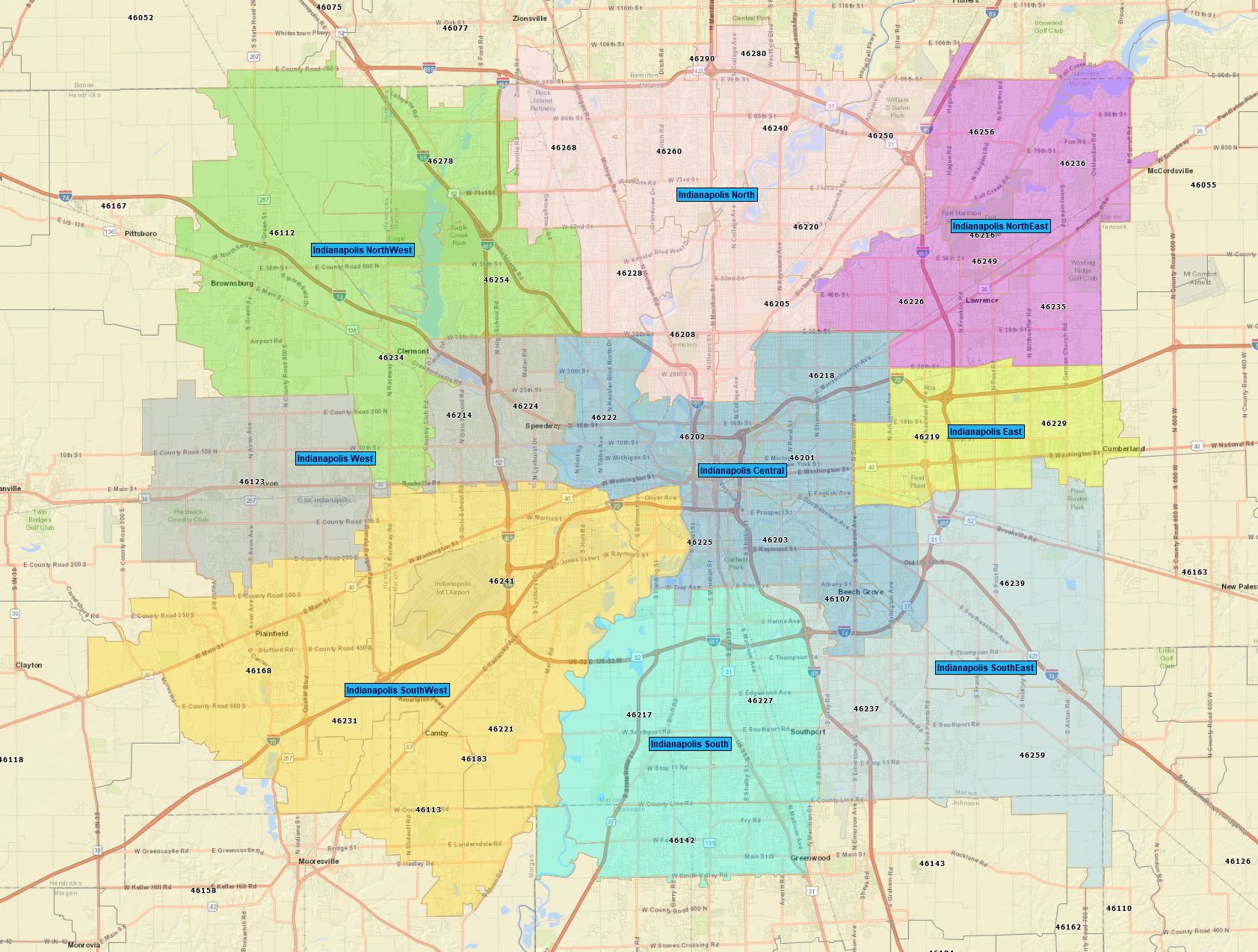
Indianapolis Indiana - Zip code match to neighborhoods and neighborhood areas
Use Cases
- Add to RealZips CRM app (Salesforce)
- Plan territories, events and campaigns across Indianapolis
- Add layers to mapping apps
Neighborhoods included
- Arden
- Arlington Heights
- Avon Creek Estates
- Ballinshire Estates
- Bierman
- Brookside
- Carriage Heights
- Cedar Springs
- Chesterton
- Copper Grove
- Crooked Creek Heights
- Cumberland Estates
- Eagle Creek Woods
- Farley
- Forest View
- Fountain Springs
- Glen Ridge Estates
- Haughville
- Hawthorne Ridge
- Heron Lake
- Hill Valley
- Kessler Walnut Hills
- Legendary Hills
- Lynhurst Garden
- Murphy's Landing
- Persimmon
- Pinecrest
- Pogues Run
- Riley Commons
- River Run
- Royal Pines
- Sargent Hills
- Sheridan Heights
- Sherwood Forest
- Southern Wayne
- Springmill Heights
- Standish Estates
- Stringtown
- Sycamore Heights
- The Commons
- Villas of Heartland
- Warren Pines
- Waverly Commons
- Woodland Heights
Neighborhood Areas included:
- Indianapolis Central
- Indianapolis East
- Indianapolis North
- Indianapolis NorthEast
- Indianapolis NorthWest
- Indianapolis South
- Indianapolis SouthEast
- Indianapolis SouthWest
- Indianapolis West
Data Source: Indianapolis Neighborhood Link. Corrections made by RealZips team.